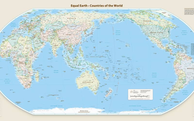

The United Nations has voted to recommend a new-look map of the world that shows countries closer to their true size, with Africa and other regions near the equator looking much bigger.
On Friday 4 September 2026, the UN General Assembly voted 164 to 1 in favour of the “Correct the Map” resolution, with six countries abstaining (choosing not to vote either way). The only country to vote against it was the United States.
The change recommends replacing the famous Mercator map, which has been used since 1569, with a newer one called the Equal Earth projection. The Mercator map is very good for sailing, but it makes places near the North and South Poles, like North America, Europe and Greenland, look much bigger than they really are. At the same time, it shrinks places near the equator, like Africa, Latin America, South Asia, Australia and Oceania.
The Equal Earth projection, created in 2018 by cartographers (mapmakers) Tom Patterson, Bernhard Jenny and Bojan Šavrič, shows land masses much closer to their real size.
Togo’s Foreign Minister, Robert Dussey, said maps matter more than people might think. “Maps shape our understanding of the world,” he said. “They guide education, nourish the imagination, and influence collective perceptions.”
Tom Patterson agreed that getting it right matters for students. “If you’re using the Mercator map as a world map… students would have a completely warped view,” he said.
The vote doesn’t force any country to change its maps straight away. Instead, it simply encourages governments and schools around the world to think about using a fairer version next time they update their atlases.

 SMART Prep | Quick Question